The 2004 tsunami stroke the Sumatra island into devastating place. Unfortunately, Aceh was one of the most damaged area because of this natural disaster. Today, after almost fifteen years, the land has been reconstructing with the help of human. However, recent topological survey shows different perspective. What is happening to Aceh?
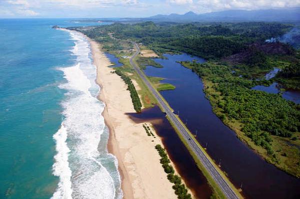
 |
| West coast of Aceh after 2004 Tsunami |
On the other hand, maintaining the beach has become the major issue as it affects the stability of marine ecosystem. During the erosion happened in the area of shoreline, the mangrove forest which is located nearby the beach will be disturbed. As a result, the ecosystem becomes unstable which can make the marine life within it endangered. When the habitats of the fish are disturbed, the effect directly influences to the life nearby including the human.
Erosion after tsunami Aceh is not merely caused by the sea wave
The fact that after 2004 tsunami, the condition of coastal Sumatera particularly in western coast of Aceh has been alternating into ridge plain, becomes national issue. More importantly, the changing of coastal environment was not merely caused by large earthquakes. Well, this natural disaster becomes trigger to initiate another natural phenomenon which is in this case affects the shoreline condition. Based on the survey which was conducted by them found the strongest reason of the changing and it was not from the earthquake.
Significant aspect of natural transforming was caused by the wind. This natural process has been transporting the sediment redistribution significantly.
Is there any causes after tsunami Aceh in 2004?
The study also found that the causes of ridge patterns in West Aceh were not merely caused by the wind and the earthquake. In fact, in some events, the covered-land earthquake process which is occurred in cyclic system becomes the reason of reconstructing. This cyclic behavior of soils generates the redistribution of soil in the shoreline and it makes the ridge patterns.
As we know that the tsunami 2004 triggered the geological process inside the crust of the earth. Geologically speaking, the tectonic system in Indonesia is quite complex as the meeting point presents there. This system also operates in frequent time in different of earthquake size, but the system is occurred in cyclic which makes the plates move. According to the Wikipedia, the Great Sumatran Fault is connected to the Australian plate located on the western part of Sumatera – including Aceh – to southern part of Java along with the northern part of Australia. It means, if the plate in Australia moves then the Sumatera will get affected.
Conclusion
Reference
[1] Monecke, K. et al., 2015. Beach ridge patterns in West Aceh, Indonesia, and their response to large earthquakes along the northern Sunda trench. Quaternay Science Reviews, Issue 113, pp. 159-170.
[2] Image is downloaded from https://pbs.twimg.com/